|
|
|
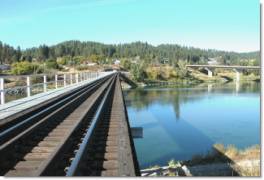
Union Pacific Railroad crossing the Kootenai River |
TRANSPORTATION SYSTEMS
Early transportation systems developed along major rivers. Given the dense vegetation in the area, some of the easiest access to the country was gained by boat. This access lent itself to the development of railroads, and later, road systems along these waterways.
|
|
|
Union Pacific Railroad crossing the Kootenai River |
Railroad
Transportation Two railroad
lines, the Burlington Northern/Santa Fe and the Union Pacific, pass through
Boundary County, though neither line has a depot in the county.
the banks of the Kootenai River from Libby to Bonners Ferry. At Bonners Ferry, it turns south toward Sandpoint. The Spokane and International Railroad, now operated by Union Pacific (UP), built tracks from Sandpoint to Bonners Ferry and up the Moyie River to Cranbrook, BC.
|
|
|
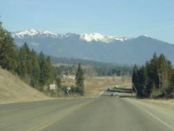
U.S. Highway 2 east of Bonners Ferry |
Roads Two US
Highways, totaling about 66 miles, cross through Boundary County.
Highway 2 and Highway 95, using
a common roadway, run north from Sandpoint through Bonners Ferry.
They diverge at Three-Mile Junction just north of Bonners Ferry.
Highway 2 then goes east toward Libby, Montana, generally following the
Kootenai River.
Highway 95 goes north from Three-Mile Junction to Mount Hall and then east to
Eastport on its route into Canada and Cranbrook, BC.
From Mount Hall, State Highway 1, which is eleven miles long, goes north
to Porthill and into Canada. These
highways are generally built to lower standards than roads in other states and
other parts of Idaho. For example,
there are fewer than four miles of four-lane highway total in the county.
The two-lane roadbeds common in the county, often constructed with poor
alignment and narrow shoulders, combine with moderate to high volumes of truck
and passenger car traffic to greatly increase the potential for frequent,
serious hazardous events.
Boundary County roadways are
maintained by several different government entities. These government entities also take responsibility for the
entire roadway structure. A network
of 343 miles of county roads provides access to residential areas outside the
Bonners Ferry and Moyie Springs city limits.
Most of these roads branch off from the state and US highways.
Few, if any, of these roads are built to high standards and this standard
is unlikely to change in the near future due to the small tax base.
The U.S. Forest Service has
primary responsibility for constructing, maintaining, and monitoring roads
within national forest ownership.
The cities have primary
responsibility to construct, maintain, and monitor roads within their city
limits. This excludes the respective state highways running through the cities.
The Boundary County Road and
Bridge Department has primary responsibility for the remaining public roadways
within its boundaries. This does not include private roadways.
Map 3-3
Boundary County Road System Map*
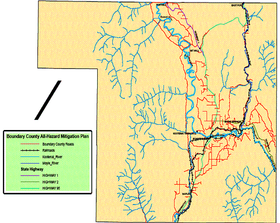
*Does not show Forest Service, Bureau of Land Management and private roads.
Map 3-4
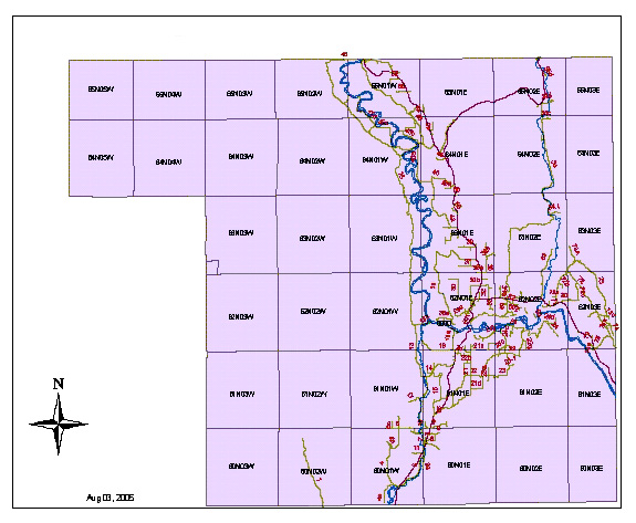
*Does
not include Forest Service, Bureau of Land Management and private roads
|
|
|
Boundary County Airport |
Air
Transportation Two airports
provide services for small aircraft; the county-owned Boundary County Airport
northeast of Bonners Ferry and the state-owned Porthill Airport, which serves as
the International Customs Airport.
Boundary County Airport provides
service for small and medium-sized aircraft.
The FAA has classed it as a B-1 airport. The runway is 4000 feet long, 85 feet wide, and has a
parallel taxi strip. The runway can
support heavy loads. Long term
plans are to upgrade the airport to a class B-2, with a runway length of 5500
feet.
Boundary County planners should factor the airports capacity and capabilities into decisions involving economic development and expansion.